Virtual Tikal: Rethinking the Ancient Maya Forest
Independent Study: Pennsylvania State University: State College, Pennsylvania
The Virtual Tikal project combined integrated field research, GIS, remote sensing, and excavation drawings published by the University Museum, University of Pennsylvania (Coe 1990) to experimentally visualize the Classic Maya site of Tikal, Guatemala, during the Classic Period (AD 250 to AD 750). This was not an attempt to reconstruct the site, but to integrate a variety of data formats (including paper) into a single digital visualization. The Digital Design process began with the digitization of site plan drawings in CAD. Topographical (contour) data was then exported from GIS to CAD and aligned with existing site plan line work. The CAD data was then imported into SketchUp where contour data was converted to a TIN mesh and buildings were modeled with reference to University Museum excavation drawings. The SketchUp model was then exported to Vue 6 Infinite via .obj exporter. Once in Vue various vegetation types and patterns were applied with reference to remote sensing data and historical documents. A variety of materials, atmospheres, and vegetation patterns were applied to the model in Vue and rendered to explore possibilities of site appearance and evolution.
Project and Image Credits:
Modeling and Visualization: Matt Zambelli
Data Collection and Instruction: Tim Murtha, PhD
 Birds eye rendering of the Tikal North Acropolis.
 Birds eye rendering over the the ancient reservoir.
 Rendering illustrating forest clearing for causeway to Temple 4.
 View from Temple 4 down causeway to North Acropolis.
 View looking north through the main plaza and temples 1 and 2.
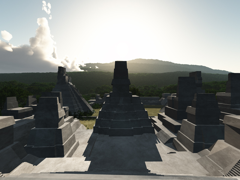
 View looking south from atop the northern most temple.
 Rendering of temple 2 illustrating image based bump map detailing.
 Birds eye showing the acropolis with a denser vegetation pattern.
 Perspective showing the acropolis becoming more overgrown.
